Many families have made the journey to the United States, as I’ve observed firsthand. Right there, they’ve got to be doing anything unusual. There are several factors why someone would choose to relocate to the United States.
The ‘American Dream,’ the prospect of a better career, or the desire to be near a dear one are all popular reasons for people to relocate.
Still, some states are not booming with an excess population right now, and today, I am going to talk about some of the least populated states in the US.
1. Wyoming
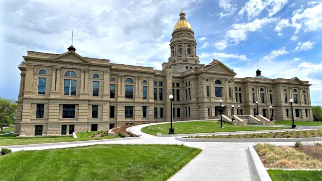
Wyoming is the most sparsely inhabited state in the United States. Its population is 581,075 with 0.60% growth rate in 2021. There are just 5.85 persons per square mile in the Union’s least densely inhabited state.
With a population density of only one person per square mile, Alaska is the only other state in the U.S. with a lower population density. Cheyenne, Wyoming’s biggest city, with a population of 63,335. Casper, with 60,285 residents, is the second-most populous city in Wyoming, while Laramie, with 32,158 residents, is the third-most populous.
Laramie County has a population of 98,327 people, whereas Natrona County has a population of 79,547. In 2005, over 51 percent of the state’s people lived in at least one of the state’s 13 major municipalities.
2. Vermont
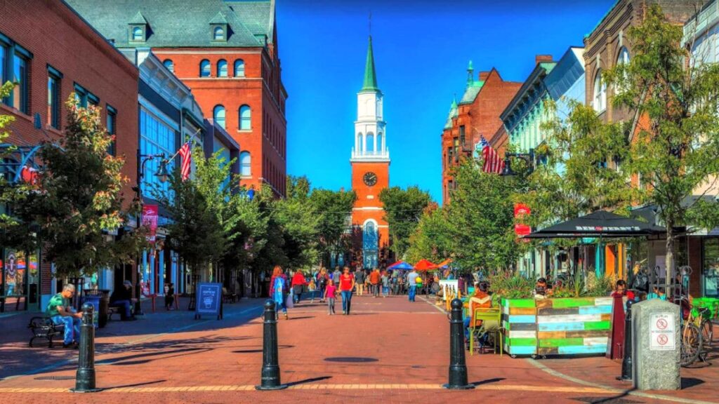
Vermont is often known as the Green Mountain State. Its population is 623,251, with a -0.18% growth rate in 2021. It is the 49th largest city in terms of people and the 45th largest in terms of land.
Vermont, on the other hand, makes effective use of its limited land area. Vermont is the 30th most densely least populated state in the U.S., with an average of 67.9 persons per square mile across its 9,614 square miles. The lack of large metropolitan centers in Vermont is unsurprising given the state’s tiny population.
Only three of Vermont’s nine incorporated cities have populations above 10,000, with Burlington having over 42,000 persons and South Burlington having 18,791 citizens. Montpelier, Vermont’s capital, is ranked fifth with 7,892 people.
3. The District of Columbia
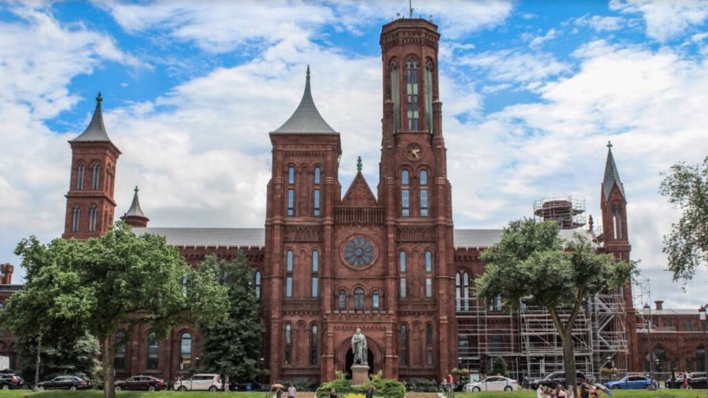
The District of Columbia, sometimes known as Washington, D.C., is the United States’ capital. The term “district” refers to the established territory, which is legally not a state but rather a federal classification. The Census Bureau considers the District of Columbia to be state-equivalent for statistical reasons.
Commuters from nearby Maryland and Virginia suburbs boost the city’s daytime workforce to more than one million throughout the workweek, despite the city’s actual rate of the population of 714,153 according to the 2021 census. From the population of 702,455 in 2018, this figure has increased by 1.3 percent.
You might also interested to know about the richest states in the US.
4. Alaska
Due to its peculiar daylight schedule and harsh cold, Alaska is a one-of-a-kind state. Despite being the largest state in size, it is also the least inhabited, with 724,357 people. That implies it barely accounts for 0.22 percent of the total population of the United States!
It is the most sparsely inhabited state in the United States. To give you a better idea, Alaska is 663,267 square miles in size, with Texas coming in second at 268,581 square miles.
The District of Columbia is the only place in the United States that is less populated than Alaska, with a population difference of fewer than 25,000 people! Anchorage, Alaska’s largest city, is home to more than 40% of the state’s population.
5. North Dakota
North Dakota, bordered by Montana, is the fourth least densely populated state, with 11 persons per square mile. Its population is around 770,026. Native Americans predominantly occupied this territory before the introduction of European immigrants. The development of the railroad drew settlers to North Dakota.
Wheat farms cover the rest of this state, protected by anti-corporate regulations that prevent banks from acquiring agricultural titles. Foreclosure is practically banned under these provisions. Previously, the state’s population had decreased due to many young people leaving to seek work.
6. South Dakota

South Dakota’s current population is 896,581, 1.17 percent up from the 2019 census and ranking 11th in the U.S. population growth. It is the 47th least populated state in the U.S., behind Delaware, based on the current population.
The state is the 16th biggest land area, although the population is little in contrast. Despite encompassing 75,885 square miles, there are barely 12 persons per square mile on average. The geographical factors, like those in North Dakota, do not allow for widespread urbanization. This, along with a shortage of job possibilities, has fueled the exodus to other parts of the country.
7. Delaware

Delaware is the smallest and least populated state in the U.S., second only to Rhode Island, with fewer than one million people. Delaware’s population climbed from899,595 in 2010 to 975,033 in 2019, then to 990,334 in the 2021 census, the 2021 census.
Despite its tiny size, Delaware has a population density exceeding the national average of 87 people per square mile, with 500 people per square mile. The total area of the state is merely 1,982 square miles. Even though Dover is the capital, Wilmington is the largest city in the state.
8. Rhode Island
In terms of volume, Rhode Island is the smallest state in the U.S. Yet, its population and population density are not laughed at. The population was predicted to be 1.06 million in 2019 and 1,061,509 in 2021, making it greater than seven other states.
The most recent official census figures from 2010 showed a population of 1.05, indicating that the community in Rhode Island has been growing since then, despite a 0.03 percent fall in population from 2019 to 2021.
The state is just 1,545 square miles in size, yet it has a population density of 1,022 persons per square mile. In terms of population, Rhode Island is second only to New Jersey.
9. Montana
Montana is the seventh least populated state in the U.S. Its population is about 1,085,004. The growth rate is 2.29 in 2021The population density of Montana, Wyoming’s northern neighbor is 7.1 persons per square mile. Homesteaders colonized Montana in the past on enormous swaths of land that were split among families.
The low population ratio and the major economic activity, agriculture, are influenced by this population dispersal. To farm cereal grain and rear livestock, vast swathes of land are required. Mountains cover regions that are not surrounded by ranches.
10. Maine
Maine, sometimes known as the Pine Tree State, is located in the far northeastern edge of the United States and is one of the least populated states in the U.S., despite moderate growth over the previous ten years. Maine’s population will be 1,354,522, a 1.15 percent increase from the 2021 census projection.
Maine’s natural scenery of mountains and rocky shoreline explains its population density of nearly half that of the rest of the country: 44 persons per square mile compared to the national average of 87. However, as a result of this figure, it is the least densely inhabited state in the United States.
11. New Hampshire
One can find the state of New Hampshire in the New England area of the northeastern part of the United States. It shares its southern border with Massachusetts, its western border with Vermont, its eastern border with Maine and the Gulf of Maine, and its northern boundary with the province of Quebec in Canada.
With little upwards of 1.3 million citizens, New Hampshire is the tenth least populated of the fifty states that make up the United States of America. It is also the fifth smallest state in terms of total land area.
12. Hawaii
Hawaii makes up the majority of the Hawaiian archipelago, which is made up of 137 volcanic islands spread out over 1,500 miles (2,400 kilometers) and is considered to be a part of the Polynesian subregion of Oceania both linguistically and culturally. Because of this, the state’s oceanfront is around 750 miles long, making it the fourth-longest in the United States (1,210 km).
13. West Virginia
One of the states that may be found in the United States’ Appalachian, Mid-Atlantic, and Southeastern areas is called West Virginia. It is bounded to the north and east by Pennsylvania, to the east and northeast by Maryland, to the southeast by Virginia, to the southwest by Kentucky, and to the northwest by Ohio.
With 1,793,716 people calling the state home, West Virginia holds the position as the 12th least populous state in the country despite having the 10th lowest land area. Charleston is both the state capital and the largest city.
There are many reasons behind these states being less populated than others. The benefit is these states are very beautiful, and you can roam around safely. Since fewer people are living in a state, congestion is much less of a problem. This results in shorter commutes, less stress, and more green space.

