
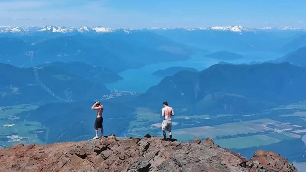
Mountains hold a greater allure for me than the most beautiful beaches with crystal-clear water. The highlands of Arizona, which are speckled with mountain ranges, national parks, and other places with naturally gorgeous landscapes, have long captivated visitors.
You’ll likely want to look over this list of some of the most significant mountains in Arizona to see if any of them fit your criteria, when you’re planning a vacation and want to take in some stunning scenery.
1. Agassiz Peak
The majestic 12,360-foot Agassiz Peak is the second-highest in the state, but is often confused with the first because of its lofty appearance. The mountain has the honor of being home to an endangered flower known as the San Francisco Peaks groundsel; because of this, hiking above the treeline is only permitted during the winter months when the ground is covered in snow.
The summit offers views all the way to the Grand Canyon, and overnight accommodation is available on the mountain at Agassiz Lodge. Visitors should be aware that they will need to obtain a Kachina Peaks Wilderness Access Permit.
2. Agathla Peak
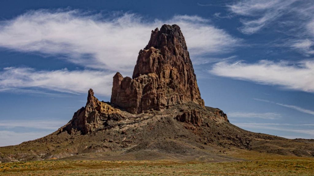
Also known as El Capitan, Agathla Peak is a sacred place for the Navajo people and was named for the animal hair that accumulated on the rock when it was used to clean animal hides. Consisting of an igneous type of rock known as minette, the mountain is part of the Navajo Volcanic Field and is actually an eroded volcanic plug that rises up quite abruptly from the surrounding flat terrain.
Reaching the 7,099-ft peak is possible but requires technical climbing skills, and the best time to attempt it is in April, May, and September through November.
3. Baboquivari Peak Wilderness
Only 50 miles away from Tucson, the Baboquivari Peak Wilderness offers some of the best backcountry rock climbing in the state. The wilderness area is 2,065 acres in size, and Baboquivari Peak itself has an elevation of 7,739 feet. There are several routes to the summit, all of which include both hiking and technical rock climbing.
The Forbes Route is often considered to be the easiest. Moreover, the mountain is of great importance in the creation story of the Tohono O’odham people, and climbers often leave trinkets at the summit for the god I’itoi.
You might also want to visit these most beautiful places in Arizona.
4. Boundary Cone
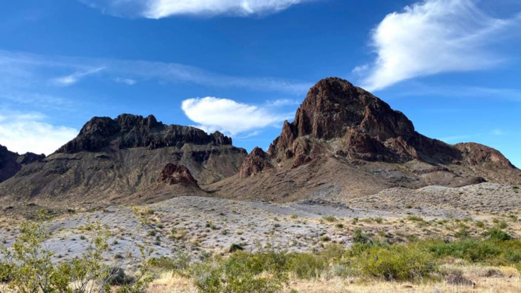
Part of the western foothills of the Black Mountains, the Boundary Cone is an easily recognizable landmark located only 12 miles away from the Colorado River. The summit sits at 3,430 feet, and a trip up and down the mountain takes approximately 3-4 hours.
Although it is not technically difficult, the ascent should only be attempted by people with some technical rock climbing skills and experience. The mountain is of great religious and cultural importance to several Native American tribes living in the area, and because of this, it is eligible to be included on the National Register of Historic Places.
5. Camelback Mountain
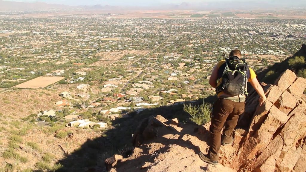
Named for its resemblance to the humps of a camel, Camelback Mountain is one of the state’s top hiking destinations. There are two main hiking routes: Echo Canyon Trail and Cholla Trail. Both take between 1.5 and 3 hours but are very difficult and should only be attempted by experienced, well-prepared hikers when the weather is appropriate.
However, the mountain gets quite busy, especially on the weekends, and visitors are advised to go early because the entry gates are closed once the park has reached capacity. Limited parking is available, but there are also plenty of bike lock racks.
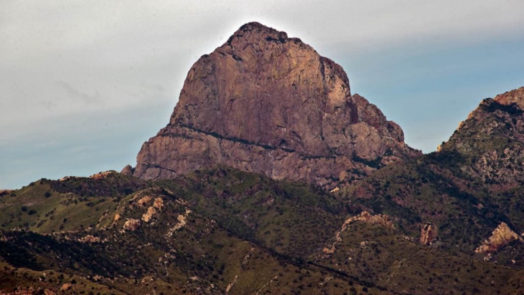
6. Carr Peak
Located in the Huachuca Mountain range, Carr Peak has an elevation of 9,229 feet. The most popular route up the mountain is the moderately difficult Carr Peak Trail, which can be easily accessed from both the Ramsey Vista Campground and the Reef Townsite Campground.
To reach the summit, you’ll need to take the short but steep Carr Peak Spur, which is located right off the main trail. In addition to offering excellent hiking, the area is also home to a wide variety of bird species, including 15 species of hummingbird and a number of species unique to the southwest United States.
Learn more about the famous landmarks in Arizona.
7. Cat Mountain
Easily accessible from Tucson, Cat Mountain is a 3,852-foot peak that offers excellent scrambling and hiking opportunities. The mountain’s proximity to the city means that many visitors choose to spend the night in one of the many accommodation options there, but 130 sites are available at the nearby Gilbert Ray Campground for anyone wishing to camp.
Since the mountain has relatively low altitude, visitors are advised to come during the cooler weather of the fall, spring, and winter; March and April are great for wildflower-viewing. No permit is required, and the park is open every day between 7:00 am and 10:00 pm.
8. Chiricahua Mountains
Formed by a tremendous volcanic eruption that occurred approximately 27 million years ago, the Chiricahua Mountains are named after the Chiricahua Apache Indians, who used to inhabit the area. The mountains have a vastly different habitat than the surrounding lowlands, and the range is home to some flora and fauna that cannot be found anywhere else.
One of the most notable features is the Chiricahua National Monument, which is full of stunning hoodoos and eroded rock spires that reach heights of more than 100 feet. Plenty of campsites can be found all throughout the mountain range, including the convenient Rustler Park.
9. Four Peaks
Visible from Phoenix, the Four Peaks rise up more than 6,000 feet from the desert and are one of the area’s most notable landmarks. Only the northernmost peak is named; known as Browns Peak, it is the highest of the four but also the least dangerous to climb.
The path to the summit involves easy hiking as well as class 3 scrambling, and once at the top, hikers will be able to see approximately 25% of the state of Arizona. It’s also possible to traverse all four peaks, although the class 4 route is 10 miles long and quite exposed.
10. Fremont Peak
One of the San Francisco Peaks in the northern part of the state, Fremont Peak is the third-highest summit in Arizona. The mountain offers better views of the surrounding area than any of the other San Francisco Peaks, but it is not often climbed because of its long approach.
This 11,969-foot summit can be reached via the challenging Arizona Snow Bowl-Humphreys Peak Trail, but other popular routes include a trail that leads into the scenic Inner Basin and the Weatherford Trail, which winds its way to the saddle between Fremont and the neighboring Doyle Peak.
11. Humphreys Peak
The highest mountain in Arizona, Humphreys Peak rises to an impressive 12,633 feet and offers views of the White Mountains and the edge of the Grand Canyon. There are two primary routes to the top: the relatively easy Humphreys Peak Trail and the more strenuous Weatherford Trail.
The best time to climb the mountain is between June and October, but some people enjoy the challenge of tackling the mountain during the winter, when it’s covered in snow. Camping is permitted on the mountain at altitudes below 11,400 feet, and campsites with vault toilets are available in Locket Meadow for a small fee.
12. Miller Peak
Situated only a few miles away from the Mexico-Arizona border, Miller Peak is part of the Huachuca mountain range and has a 9,470-foot summit. There are several routes to the summit, but the most popular is the Crest Trail, which can be accessed from the north, east, and south and leads hikers along the crest of the main range.
Since the mountain’s proximity to Mexico, hikers should be aware that they might cross paths with illegal immigrants or with Border Control agents on patrol. The peak can be hiked all year round. There are also two campgrounds which are located near the north trailhead.
13. Mount Baldy
Named for its strikingly bare peak, Mount Baldy is the highest mountain in the state outside the San Francisco Peaks area. Two trails, known as West Baldy and East Baldy, lead up the mountain to a point near the summit; each trail is approximately 7 miles in length, and they can be combined to make a loop.
However, the mountain’s summit lies inside the Fort Apache Indian Reservation and is off-limits to hikers unless they get special permission. The mountain also produces more rivers and streams than any other in the state, and it offers the best trout fishing streams in Arizona.
14. Mount Graham
Home to the Mount Graham International Observatory area, Mount Graham is one of the Pinaleno Mountains in southeastern Arizona. The summit sits at 10,724 feet, but hikers are required to stay under 9,800 feet because of the mountain’s sacredness to the Native Americans as well as the presence of an endangered squirrel species.
Some people choose to hike all the way to the summit regardless, but much better views can be had from the summits of nearby mountains such as Heliograph Peak and Ladybug Peak. The access road to the mountain is often closed during the winter due to poor road conditions.
15. Mount Lemmon
Located in the Coronado National Forest, Mount Lemmon boasts a summit of 9,157 feet. Plenty of marked and unmarked trails crisscross the mountain, including the 800-mile Arizona Trail, which runs from the Mexican border to northern Arizona.
The summit is also accessible by car or bicycle thanks to the beautiful Catalina Highway, which runs right up to the top of the mountain; tolls are charged to anyone wishing to park, camp, or hike in the area. The Mount Lemmon Ski Valley is located on the northeastern side of the mountain, and the small town of Summerhaven sits near the summit.
16. Rincon Mountains
The Rincon Mountains, one of the five mountain ranges that make up the Tucson Valley, are primarily found inside Saguaro National Park. It is the only significant mountain range in the state that has never had a road cut through it, thus the surroundings are incredibly untamed and unspoiled.
17. Piestewa Peak
Piestewa Peak, a 2,610-foot mountain close to Phoenix, is named for the first female combat fatality in the Iraq War. To reach the summit of the mountain, hikers can use the 1.2-mile Piestewa Peak Summit Trail, although they should be warned that the trail is more challenging than it first appears.
18. Picacho Peak
Picacho Peak, a difficult 3,374-foot summit created by volcanic lava, is conveniently situated halfway between Phoenix and Tucson. Although there are cables and catwalks to assist hikers along the more hazardous portions of the trek, the path to the mountain’s summit is fairly challenging. It is advised to wear gloves when handling cables.
Visitors are required to pay a minor entry charge and an additional fee if they want to utilize the campground because the mountain is a part of Picacho Peak State Park.
As a tourist in Arizona, you must visit one of those major mountain settlements that exist. If you’re thinking about taking a trip soon, now you know that you won’t have to worry about where to go to explore some beautiful landscapes.